2025 Africa - Land Safari in Botswana and Culinary & Cultural Cruise on SilverSea, Silver Wind, Cape Town, South Africa to Accra, Ghana - PART II
- jcapurro1
- Apr 5
- 25 min read
Updated: 5 days ago

. . . the day before. . . . upon arriving in Cape Town, we were met and escorted to our hotel, one of the prettiest hotels in which I've had the pleasure to stay - One & Only. I'd not heard of One & Only hotels before this trip, but found out they are all over the world. This one boasts a Nobu restaurant, the only Nobu in South Africa.

Since I'd not ever been to a Nobu restaurant, Eric, Diane and I decided to go for dinner. I was excited about this! The restaurant was awesome! . . . so was the very large bottle of sake!


Thursday, April 3 - Cape Town - Boarding Silversea Silver Wind
Cape Town, city and seaport, legislative capital of South Africa and capital of Western Cape province. The city lies at the northern end of the Cape Peninsula some 30 miles, at its southernmost boundary, north of the Cape of Good Hope. Because it was the site of the first European settlement in South Africa, Cape Town is known as the country’s “mother city.”
Cape Town has a beautiful setting: parts of the city and its suburbs wind about the steep slopes of Table Mountain (3,563 feet high) and neighboring peaks and rim the shores of Table Bay; other parts lie on the flats below the slopes or stretch southward across the flats to False Bay. The city covers an area of 116 square miles. Pop. (2005 est.) urban agglomeration, 3,103,000.
Eric had scheduled a seven hour road tour around Cape Town environs, along the coast. The tour would include lunch with a delivery to the ship at around 3:00 p.m. The sights were wonderful! Cape Town has an incredible setting, with the ocean and the dramatic mountains. In one area are promontories designated as the Twelve Apostles. The road is carved right into the rock and in a few areas one travels through rock ceilings . . . you know that the mountain is above you.


A lunch stop at Food Barn - quite good!


We arrived at the ship on time, checked in, did the muster drill via the television in my suite, and a visit to the muster station . . . and the sun was setting. Luggage finally arrived in the room and I decided to stay in, unpack, get settled and skip dinner - our late lunch had been more than adequate.

.
Friday, April 4 -Saldanha, South Africa
Situated in the northern corner of South Africa’s largest natural Bay, Saldanha is known for its contrasts and natural beauty.
Saldanha Bay is named after António de Saldanha, captain of a vessel in Albuquerque’s fleet which visited South Africa in 1503. The name was first given to Table Bay, where Saldanha’s ship cast anchor. On Table Bay being given its present name in 1601, the older appellation was transferred to the bay now called after Saldanha. In 1781 a British squadron under Commodore George Johnstone seized six Dutch East Indiamen, which, fearing an attack on Cape Town, had taken refuge in Saldanha Bay. This was the only achievement, so far as South Africa was concerned, of the expedition despatched to seize Cape Town during the war of 1781-1783.
The bay also hosts a naval training base and the South African Military Academy, in which can be found a pristine nature reserve which becomes a floral wonderland in
spring. There are well-established hiking trails and several great vantage points from which to view the majestic Southern Right Whale in calving season.
Waited and waited this morning for my tour to be called. It was to begin at 9:00 a.m. - a walking tour. Finally went down to the exit at 8:50 to find out that the tour had left five minutes before! UGH! Back to my room to catch up the blog, and take a nap.
Enjoyed a quiet dinner by myself at La Terazza, and so, to bed . . .
Saturday, April 5 - At Sea
Eric hosted a cocktail party for the whole group who are now on the ship. Added to the seven who were on safari, there were additional members of his group who only wanted to cruise. Everyone seems nice and happy to be all together.
Eric and Diane asked that I join them for dinner at La Terazza. We had a great dinner, with some wonderful Brunello di Montalcino wine from Italia.

Sunday - April 6 - Luderitz, Namibia

Lüderitz is a town in the ǁKaras Region of southern Namibia. It lies on one of the least hospitable coasts in Africa. It is a port developed around Robert Harbor and Shark Island. Lüderitz had a population of 16,125 people in 2023.
The town is known for its colonial architecture, including some Art Nouveau work, and for wildlife including seals, penguins, flamingos and ostriches. It is also home to a museum and lies at the end of a currently decommissioned railway line to Keetmanshoop. The town is named after Adolf Lüderitz, founder of the German South West Africa colony.

Well, I'm batting zero for two! Waited again for my walking tour to be called. Everything was delayed because of people not going through immigration prior to leaving the ship. They never called my tour, so I stayed on board again. Unfortunately, these stops are not such that I cannot go in to town alone - at least that's what we've been advised.
Those people coming back from the walking tour say that I didn't miss much - that makes me feel better . . .
Had to go through a face-to-face immigration drill today, with our passports, and then turn them back into the ship's care.
A light dinner tonight ensuite - Caesar salad and a spring roll. Had three quarters of a hamburger for lunch, so not too hungry.
Monday - April 7 - Walvis Bay, Namibia
The town of Walvis Bay lies on the edge of the Namib Desert at the mouth of the intermittently flowing Kuiseb River. A portion of the town lies below sea level (4 feet) and is protected by a dike against flooding. Walvis Bay Harbour serves as Namibia’s chief port. It is sheltered by Pelican Point Peninsula on the northwest and is connected to the interior by road, rail, and air. The harbor was formerly a deepwater anchorage for the South African navy, and since the late 1970s the port has exported uranium from one of the world’s most important deposits, at Rössing, 50 miles northeast. Severe coastal overfishing from the mid-1970s caused a decline in importance of the town’s former economic mainstay. Pop. (2001) 43,611; (2023) 102,704.
Awakened this morning to the ship's foghorn going off with intermittent blasts. We were fogged in, so I expected another grey and wet day. But, alas, sun came out around 9:30, the skies are blue and we are berthed in Walvis Bay. Not going on a tour today (I'd probably miss it anyway!!), but most of the guests will be going to a special dinner tonight, me, too, if I don't miss my connection!!
This port is very large with tons of containers and davits dotting the shore. From where I sit on the pool deck, I can't see anything much interesting.
Tonight is the Marquee Dinner out in the dunes. We will be transported by busses and
4 X 4's. It took about an hour to get there. We drove a good highway, all the while seeing the barren desert on either side of the highway. Once off the highway, we traversed a rutted dirt road toward a huge dune, hopefully, in time to see the sun set over the dunes. . . and we did . . . barely.

The area at the foot of the dune had many cocktail tables laden with at least a thousand (or more) squares of cheddar cheese (never saw so many!), and crackers, while attendants passed out trays of champagne. Some intrepid guests climbed the dune . . . all I could think of was sand in my shoes!

Then it was back into the vehicles to be transported around the other side of the dune where an elegant, and huge, tent had been set up to accommodate us for a dinner. The setting was really beautiful with hundreds of candelarias lighting the foreground. Three people also performed with lighted torches and contraptions. I was told the next day that the reason we transported in vehicles to get to the other side of the dune (a short way) was because there were vipers (snakes!) on the ground! So happy I didn't know that!

During dinner we were entertained by local African male group who sang and danced - love the African rhythms!
Dinner was good, buffet style, and featured food cooked with spices of the area. I enjoyed my first taste of gemsbok, an antelope native to Namibia. It was really tasty and not at all gamey!
Nice evening . . .
Tuesday - April 8 - Walvis Bay, Namibia
We are still in Walvis Bay, due to leave at around 2:00 p.m. Another immigration drill this morning for those of us leaving Namibia - everyone on the ship is leaving Namibia! Curious!
Had a late start this morning and went out (after immigration drill) to have lunch and catch up blog. Went to bar to order a Bloody Mary and began speaking with a woman who was also having a beverage. Turned out that she lives in Marin County just fifteen minutes from me - isn't that curious? We're having dinner tonight in the main restaurant.
A note to my cruise mates from January - have not played Trivia on this trip because I can't bear to be without all of you for that game!!!
Wednesday, April 9 - At Sea

A quiet day, weather still not too warm, need a sweater when outside in the shade. A nap, some blog and photo work, and dinner in the main restaurant with Karen and Richard from Alameda. Am not impressed with the restaurant food, but have noticed what other people are ordering and the steak and prime rib entrees look the best. Perhaps another night.
Thursday, April 10 - Namibe, Angola

On the coast, in the far southwest of Angola, bordering Namibia, lies the city of Namibe. Formerly known as Moçademes. This pleasant city has many beautiful Portuguese buildings and is located in the Namib Desert. For that reason, you will certainly notice the difference in climate. The Welwitchia Mirabillis, one of the strangest plants in the world, can be seen in the surrounding area. The plant has only two leaves and grows very slowly. On average, the plants are about 500 to 600 years old, but it is known that some specimens are as old as 2,000 years old. As the South African name 'two-blaarkannie death' indicates, this plant has only two leaves.
In Namibe Province, ocean, desert and savannah landscapes come together. Breathtakingly beautiful vistas glide past you. At the mouth of the Kunene River you will find bizarre landscapes, a great contrast to the spectacular coastal strip where sea turtles, dolphins, flamingos and pelicans live. In this region lies also the rugged Iona National Park . . where the world can't find you. . .
The tour chosen today was Welwitschia and The Lost Oasis.
Welwitschia is a monotypic genus (that is, a genus that contains a single recognised species) of gymnosperm, the sole described species being the distinctive Welwitschia mirabilis, endemic to the Namib desert within Namibia and Angola. Welwitschia is the only extant genus of the family Welwitschiaceae and order Welwitschiales in the division Gnetophyta, and is one of three extant genera in Gnetophyta, alongside Gnetum and Ephedra. Informal sources commonly refer to the plant as a “living fossil”.
Welwitschia is named after Austrian botanist and doctor Frederick Welwitsch , who described the plant in Angola in 1859. Welwitsch was so overwhelmed by the plant that he "could do nothing but kneel down . . . and gaze at it, half in fear lest a touch should prove it a figment of the imagination." Joseph Dalton Hooker of the Linnean Society of London described the species, using Welwitsch's description and collected material along with material from artist Thomas Baines who had independently recorded the plant in Namibia.] Welwitsch proposed calling the genus Tumboa after what he believed to be the local name, tumbo. Hooker asked Welwitsch for permission to name the genus Welwitschia instead. Welwitsch concurred and supplied some well-preserved material from which Hooker was able to make substantial progress in determining its botanical affinities.
The plant lives for one thousand years!!
It took us one hour to reach Welwitschia, and another forty-five minutes after that stop to go to The Lost Oasis. The highway was fine and our driver put the pedal to the medal to get there, but it was imperative to slow down once we hit the dirt bumpy roads into each site . . . like five to ten miles per hour!!! That took forever . . . Found it interesting that tour groups travel in convoy style, always staying together.
I believe the Namib desert is the third largest in the world, so dry. At both locales, people leave their refuse - it's a shame they can't carry out candy wrappers and plastic water bottles.
As in the American Southwest, I find the desert beautiful, in a rare and dramatic way.
At Welwitschia . . .


At The Lost Oasis . . .


After the miles and miles of arid desert, it is startling to suddenly see so much greenery . . . ergo, the oasis. It was a very long trek from the vehicles to the lake and a natural arch. I didn't make it. Just five minutes shy, but the hike was a long and hot one and I knew I still had to make it back. With the help of a tour guide and also a member of the expedition team, up and down some steep and slippery grades, I made it back to the van!
On the way back, we stopped at a local Catholic Church and then walked to tour the Naval installation. Interesting.


Most people here seem to speak Portuguese - at least that's how I hear it.
Dinner last night at patio, poolside. Lovely grilled vegetable salad, small filet and baked potato - really good!
Friday, April 11 - At Sea
An easy day, some computer time is in the offing. Weather has warmed considerably, tending toward hot! There was a wine tasting scheduled for this afternoon, but it has been cancelled. Probably not enough signups. The safe in my room has decided not to recogize my code, so have to get someone to open it.
By chance some of us from the safari met up in the Panorama Lounge and decided to have dinner out on the deck. It's quite warm now in the evenings.

Saturday, April 12 - Luanda, Angola
Luanda, city, capital of Angola. Located on the Atlantic coast of northern Angola, it is the country’s largest city and one of its busiest seaports. Founded in 1576 by Paulo Dias de Novais and initially settled by the Portuguese, Luanda became the administrative centre of the Portuguese colony of Angola in 1627 and was a major outlet for slave traffic to Brazil. The city is regarded as the capital of the Mbundu peoples, who have their roots in the surrounding area.
Luanda has a warm equable climate. The surrounding region fronts a tropical coastal plain that gives way to a tableland dissected and drained by the Cuanza River and other coastal streams. Cambambe Dam, 110 miles to the southeast on the Cuanza, supplies power to Luanda. Skyscrapers and wide avenues give Luanda a modern appearance. The higher part of the city, consisting of the outlying districts, is generally poverty-ridden, and the lower is commercial and industrial. The city is the seat of a Roman Catholic archdiocese and is home to Agostinho Neto University (1963) and the Catholic University of Angola (1997). The National Library of Angola and the National Historic Archive are also located there, as are several museums.
Though I was going on a tour that was to include a local lunch, cholera has been reported in the area, so we have a choice to come back to the ship for lunch - that's me!!
Woke up this morning feeling very under the weather. There's a bug going 'round the ship and I think it's found me. Didn't go on the tour which in hindsight was probably a good idea. The tour ran two hours over long!!


Sunday, April 13 - At Sea
Awoke feeling better. Glad today is a day at sea. Am going to check on what I've signed up for in future days before I decide to go.
Just announced that the Captain is giving an "operational update" on the rest of the cruise - guess that might mean a change in schedule? At any rate, I'm going down to see what's up.
Just back from the gathering, and Captain advised that extremely high security risk (piracy) has been reported on Bom Bom Island, which was to be an all day beach day. To be safe we are skipping the outing on April 16, and having a sea day. There was lots of grumbling, but from what was reported, every possible avenue has been investigated, and the answers were all negative. According to the Captain, unlike Europe, Africa does not have alternative safe ports where this ship could go.
So back upstairs, perhaps to sit outside and have an Aperol. But, alas, thousands of flies have taken up residence on the tables and chairs. Got a drink from the bar to take back to my suite. Then noticed there was a drowned fly in my glass. Back to the bar for a fresh glass . . . UGH! I hate flies!
Nice dinner last evening with Richard, Karen, Jen and Mike at La Terrazza. Food there is quite good - most of it!! Began my dinner with a Potato Gallette called "Frico", followed by a veal cutlet served with a bit of salad on top - nice taste contrasts. Two beautiful wines from Italy were the hit of the evening.


Monday, April 14 - Pointe Noire, Republic of the Congo
Pointe-Noire, town (commune), principal port of Congo (Brazzaville). It lies at the Atlantic coastal terminus of the Congo-Ocean Railway, 95 miles north of the Congo River and 245 miles west of Brazzaville, the national capital. Between 1950 and 1958 Pointe-Noire was the capital of the Moyen-Congo region of French Equatorial Africa. With independence in 1958, it was replaced by Brazzaville as the national capital but remained the primary entrepôt and second largest city. The Congo-Ocean Railway from Brazzaville to Pointe-Noire was completed in 1934 to bypass the rapids of the lower Congo River. The city is situated on a calm bay, but its port facilities were not completed until 1939; they were expanded during World War II. An international airport was built south of the town. Later, light industries and mineral-processing plants were established, but the city’s chief importance remained its transit trade. In the 1970s, petroleum drilled offshore near Pointe-Noire and processed at a refinery in the town became a major national export. Pop. (2005 prelim.) 663,400.
Because of the Bom Bom Island cancellation, the time at Pointe Noire has been extended. Not certain how that will affect my tour because with the extension, tour times will be changed.
Have elected to stay on board and forego the tour today which turned out to be almost three hours of hiking. Not in this weather which is hot and steamy. Temperatures in the 80's and humidity in equal numbers, the mid 80's!!
Sitting in the nice, cool Panorama Lounge, looking at the very busy port . . . moving davits straight ahead, and along the side of the ship, a fair supply of containers waiting to be onboarded.


My tour was to be a "walk" in and around the Diosso Gorge. Since I'm not going to chance going out today, have done some googling on the subject and found some photos.
I know this is not as good as actually being there . . .


Erosion in the area has created the nearby Diosso Gorge, known as the "Grand Canyon of the Congo". It has also been called the Diosso Amphitheater. Within the gorge's rainforest, there are rock ridges and distinctive red rock cliffs, which can reach up to 165 feet in height. The New York Times described Diosso Gorge as "a stunning gorge of plunging, pink cliffs draped with green Central African jungle."According to reports, Gamissamy Issanga, the director of environment at the Congo's research ministry, once approved the dumping of one million tons of oil, acids and solvents in the gorge. The gorge is said to be inhabited by the female spirit of Mboma, who takes the form of a snake.
The Safari Seven met for drinks in the Panorama Lounge, and they discussed their tours of the day, which included the tour that I'd chosen not to attend. Karen said that she was hoping I'd decided not to go. Extremely hot, no shade respite, and lots of walking. Added to that was the "welcome" of locals along the way as the bus traversed the long route. Guests had been asked not to photograph villagers, though some did anyway. Perhaps that is why locals reacted with middle finger salutes and jeering. . . or perhaps not the reason . . . Their antics made for very uncomfortable passengers on that particular tour bus.
Eric and Diane however, on a jaunt to see the Jane Goodall's chimpanzees and do a river cruise had the opposite reception from locals, and at the Rehab Center, found the chimps funny, full of personality, and most entertaining. Goodall's work with chimpanzees in the Republic of Congo focuses on rescuing, rehabilitating, and reintroducing orphaned and injured chimpanzee at the Tchimpounga Chimpanzee Rehabilitation Center, the largest chimpanzee sanctuary in Africa. According to my research many of the chimps have been orphaned because of the illegal bushmeat trade.

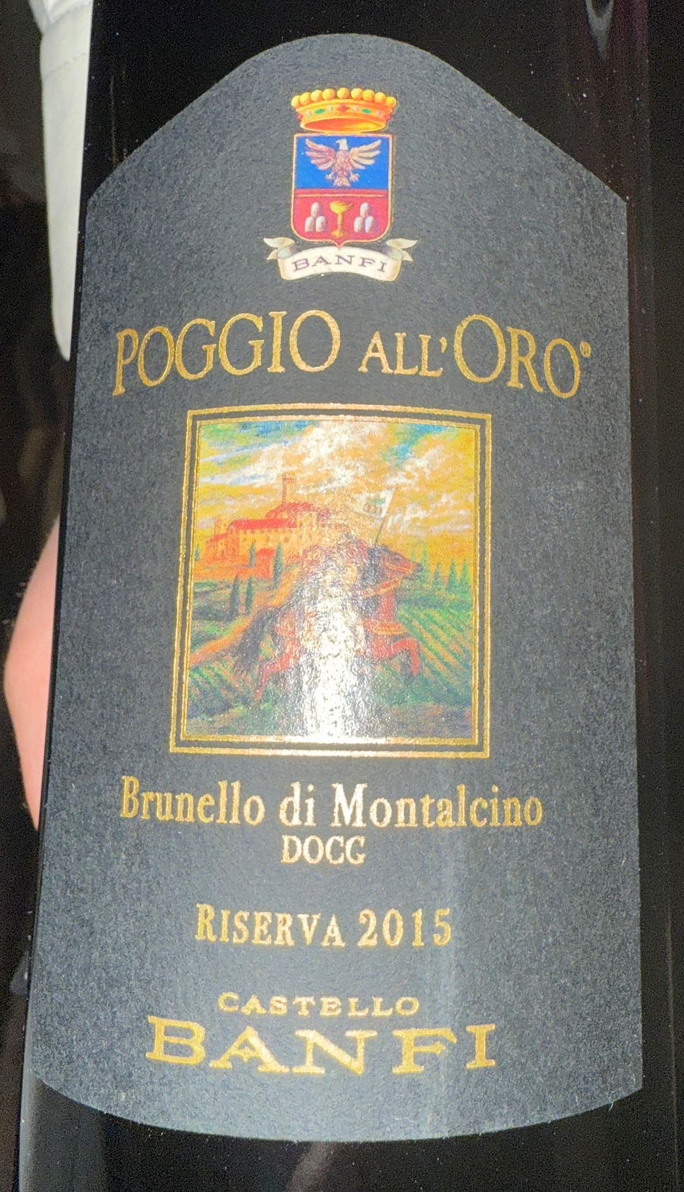
Dinner tonight with Eric and Diane at La Terrazza. We all agree that this restaurant has the best food on the ship . . . so far. Haven't yet tried La Dame, which I believe one must reserve, and there is an up charge for any meal there. Enjoyed another good bottle of Banfi Brunello - so good.
Dinner at this restaurant is always begun with a huge cheese and meat board, with some spreads, and assorted breads including focaccia. It is way too much, so we asked for a small plate of the parmesan and prosciutto. Delizioso!

Tuesday, April 15 - At Sea
This will be the first of three consecutive days at sea. We will be crossing the equator, so my guess is that we will meet King Neptune somewhere along the way!
Spending another morning in the Panorama Lounge. It is sweltering outside - don't know how guests can linger there around the pool, but not in it!!
Going down to the restaurant in a while for the seafood buffet, then decided to skip it. Not very hungry, Today is the day that my good friend, Caroline, is having back surgery. l eagerly await that all is well and pray that the outcome is all that is hoped for.
Stayed in all afternoon, had an early in-suite supper (a pretty good steak sandwich), and awaited news from friends.
Since the heat and humidity has dictated as to how much I can participate on shore, am grateful for the blogs from Eric Goldring who is getting his fill of the wonders of West Africa. His photos and descriptions are wonderful, so I urge you to click on the links I have added to this blog.
Wednesday, April 16 - Bom Bom Island, Sao Tome and Principe (CANCELLED due to high security risk). Instead - Day At Sea
São Tomé and Príncipe, officially the Democratic Republic of São Tomé and Príncipe, is an island country in the Gulf of Guinea, off the western equatorial coast of Central Africa. It consists of two archipelagos around the two main islands of São Tomé and Príncipe, about 93.21 miles apart and about 155 and 140 miles off the northwestern coast of Gabon. With a population of 201,800 (2018 official estimate), São Tomé and Príncipe is the second-smallest and second-least populous African sovereign state after Seychelles.
The islands were uninhabited until their discovery in 1470 by Portuguese explorers João de Santarém and Pedro Escobar. Gradually colonized and settled throughout the 16th century, they collectively served as a vital commercial and trade centre for the Atlantic slave trade. The rich volcanic soil and proximity to the equator made São Tomé and Príncipe ideal for sugar cultivation, followed later by cash crops such as coffee and cocoa. The lucrative plantation economy was heavily dependent upon enslaved Africans. Cycles of social unrest and economic instability throughout the 19th and 20th centuries culminated in peaceful independence in 1975. São Tomé and Príncipe has since remained one of Africa's most stable and democratic countries. São Tomé and Príncipe is a developing economy with a medium Human Development Index.
The people of São Tomé and Príncipe are predominantly of African and mestiço descent, with most practicing Christianity. The legacy of Portuguese rule is also visible in the country's culture, customs, and music, which fuse European and African influences. São Tomé and Príncipe is a founding member state of the Community of Portuguese Language Countries.
It's a really good thing that this beach day was cancelled because we had rain all day - best thing about that was that the temps cooled down considerably!!
When doing one of Goldring Travel's Culinary and Cultural jaunts, Eric always arranges special things aboard ship for his group. His planning always contributes memorable and outstanding experiences to our journeys. Today, we are invited to a private African wine tasting and lunch. Be prepared for some good food photos!


Chef Pia has promised printed menu and perhaps recipes prior to end of cruise.
The photos above are from Eric's African wine and food tasting. Interestingly, members of the crew from Africa were asked: "What is your favorite food from home?" Chef Pia then created these dishes from their input. Food was delicious! Wine was surprisingly good, and Eric has gifted each of us with a bottle of 2025 Angolan wine (the middle one in the wine photo). Thought it had some maturing in its future and am bringing it home to open in two years. Sommelier recommended that we drink within three years. The wine from Angola that we tasted today is made by a Portuguese family, so has some tendencies of Portuguese wine. However, given the different soil and growing seasons, it is a different wine. I believe it was also stated that the original vines were brought from Portugal to Angola.
My favorite wine was the first one from South Africa , Cederburg's Chenin Blanc. Will try to get some of this when I get home. It's a perfect sipping wine on a hot summer day.
In the evening Eric, Diane and I had dinner at La Dame. While you can order a five-course, or seven-course meal with wine pairings, we each chose to order ala carte and chose a beautiful wine - Lynch-Bages, a Bordeaux from Paulliac, France. A special tasting experience.
The meal began with champagne.

I ordered a lobster and fruit salad, followed by duck breast that was served with a cherry sauce, carmellized onions and a finely julienned, crystallized orange peel. Somewhere there was also a hint of licorice, perhaps with some cooked fennel. Innovative flavors that all worked together.


We each ended the meal with a Pistachio Souffle (a signature dessert at La Dame), and were offered a glass of port alongside. Choice of dark chocolate sauce or caramel on the souffle..


A day filled with good and fine wine . . . and food - perfect!
Thursday, April 17 - At Sea
A quiet day today. Too hot and humid to be anything else but quiet. Most guests hung out by the pool. Some are now so tanned that they're beginning to look like native Africans!
Discovered a new drink today, recommended by Karen - a Pineapple Sour. This is one I will probably try to recreate when at home for a summer cooler.

We've arranged a Safari Seven dinner as our last hurrah together as we edge ever closer to the end of the cruise, and will be dining tomorrow night at La Terrazza.
Friday, April 18 - Lome, Togo
Lomé (loh-MAY) is the capital and largest city of Togo. It has an urban population of 837,437 while there were 2,188,376 permanent residents in its metropolitan area as of the 2022 census. Located on the Gulf of Guinea at the southwest corner of the country, with its entire western border along the easternmost edge of Ghana's Volta Region, Lomé is the country's administrative and industrial center, which includes an oil refinery. It is also the country's chief port, from where it exports coffee, cocoa, copra, and oil palm kernels.
Its city limits extends to the border with Ghana, located a few hundred meters west of the city center, to the Ghanaian city of Aflao and the South Ketu district where the city is situated, had 160,756 inhabitants in 2010. The cross-border agglomeration of which Lomé is the centre has about 2 million inhabitants as of 2020.
I didn't have any tours scheduled today, most are eight to ten hours long, and in this heat, don't think I'd make it back to the ship. So will pretend that this is my private yacht for the day, although there are a few others who also remain on board.
Dinner tonight in La Terrazza with the Safari Seven - fun. Good food and lots of laughter!


The latest blog from Eric Goldring beautifully captures the costumes and customs of the voodoo community. Well worth a look!
Saturday, April 19 - Lome, Togo
The city was founded by the Ewes (an ethnic group who live in Western Africa and whose language falls into the Gbe Language family) and expanded in the 19th century by German, British and African traders, becoming the capital of Togoland in 1897. At the end of the 19th century, British customs duties on imported products (especially on alcohol and tobacco) weighed very heavily. The traders, mainly maritime Ewe or Anlo from the area between Aflao and Keta in the east of the British colony of Gold Coast, then looking for an alternative place to unload goods while being out of reach of British customs officers, naturally targeted the coastal site of Lomé, nearby. This commercial dynamic of customs circumvention and tax evasion then favored the expansion of Lomé around 1880. The calm and sparsely inhabited Loméen coastline began to be populated rapidly. The Ewes were soon joined by European, British and especially German companies, as well as itinerant merchants from the interior, such as the Hausa caravans from the cola roads. Many people were attracted by the new economic hub that Lomé represented. The rapid growth of the city was reinforced, and Lomé quickly earned a reputation as a place where good business was done.
Woke up to the rain, although it was clearing. Would I go on tour today, or not . . . NOT! Outside it's like a swamp. It's 6:00 a.m. and temperatures are already in the 80's. Humidity is once again going neck-in-neck with the temperature. Really can't do it! This has been an interesting cruise for me, because most of what I've seen of these countries is from the deck of the ship! Several people have become ill on these tours, so think staying on the ship has been smart for me. I am grateful that I can be sharing Goldring Travel's blog links in this journal so that there is first hand reportage on these interesting countries.
Met Richard and Karen in Panorama Lounge for a cocktai and found that Karen was in a right arm sling that immobilized the elbow. They'd gone out early on a birding expedition and Karen had fallen and broken her elbow. We are getting off the ship in two days and she will be heading home for surgery . . . UGH!
The ship is now moving through the night and the weather on deck is comfortable, so we decided to dine at the poolside grill. It was very comfortable, and the staff there is so much fun!
Sunday - April 20 - Takoradi, Ghana
HAPPY EASTER! HE IS RISEN!
Sekondi-Takoradi, port city on the Gulf of Guinea (an embayment of the Atlantic Ocean), southern Ghana.
Both the Dutch and the British built forts at Sekondi in the 17th century that were destroyed by the Ahanta. Fort Orange, rebuilt by the Dutch and bought by the British in 1872, survives as a lighthouse. Sekondi flourished in the 1900s after construction of the railroad to the interior gold fields. Its surf port became commercially obsolete, however, with the opening of the artificial harbor at Takoradi in 1928. Sekondi and Takoradi, a single municipality since 1946, became one city in 1963.
Sekondi is a mixture of old and new buildings on a hilly site, extending to the seashore. The old port is used by fishing and pleasure craft, and a naval station is nearby. Takoradi is well-planned, with modern buildings and tree-shaded residential areas. Two breakwaters enclose 220 acres of sea with quay berths and lee facilities for loading bauxite and discharging oil. The harbor is the terminus of several Ghana railways and is served by road and air. Sekondi-Takoradi also has light industrial, agricultural, and fishing enterprises. Its busy market and street vending activities are conducted by women. Pop. (2000) 289,593; (2010) 539,548.
For the first time on this cruise, I see there is a wonderful bazaar set up on the pier. Time to go shopping!! OMGosh, it is so hot and steamy, locals are offering me an umbrella - am determined to tough it out!


My first stop was at a stand run by Rebecca and Grace. So delightful, these two women. They have some really wonderful garments and I bought two, and was gifted a third item - a t-shirt, making me an honorary member of "Women Entrepreneurs in Action". Was also introduced to two handsome young men, I believe Rebecca's children, one named "Prince", and the other named "GodBless".
Everywhere I went this morning I greeted people with "Happy Easter", got the same greeting back with huge smiles, and often, a hug . . . amazing! . . . and a few . . . "He is risen!"

I bought an open front, long jacket that is made with the same technique as their two skirts. I asked about the process and was informed that when items don't sell, they are cut into strips and fashioned into this mesh fabric, and then tops, skirts, coats, capes, etc. Also purchased a native two-piece, black and white costume, together with matching fabric to wind around the head in true Ghanaian fashion. Have no idea where I will wear this, but can only hope that somewhere there will be an African themed party! Will have to google how to do the head wrap! And with those purchases all the funds that I had with me were gone! So browsed a bit, before meandering back to the ship.


Missing my family this Easter. Hope they are enjoying each other, some good wine, and I know lots of good food at the home of Sandi and John.

Monday - April 21 - Tema (Accra), Ghana
Population (1990 estimate) 180,600.
Distance From Accra (16 mi.)
Tema city is located in Southeast Ghana, near Accra. The City was built in 1960 as a manmade harbor. Its port, developed in the 1950s and opened in 1961, is the busiest in Ghana.
With the opening of an artificial harbor in 1961, Tema developed from a small fishing village to become Ghanas leading seaport and an industrial center. Most of the country's chief export, cacao, is shipped from Tema. The city has industries producing aluminum, refined petroleum, chemicals, food products, and building materials.
Tema is considered the "heart of the country's development".
Just saw on the news that the Holy Father, Pope Francis, has gone home to his Father. Requiescat in pace . . .
Am in my suite, sorting through clothing and packing up. Hard to believe that this trip is coming to a close. Eric and Diane have elected to stay on the ship for another ten days. That will allow them more ports of call in this part of the world. No doubt that Eric will continue to blog so I will include the links at the end of this journal.

Tuesday and Wednesday, April 22 and 23 - Leaving Silversea - ,Accra, Ghana to Dubai
Out of my suite by 8:00 a.m. Off the ship by 8:30 a.m. to meet the group dockside, look for Eric to point us in the right direction for our transfer to the Labadi Beach Hotel, which is about a one hour ride. We have use of the facilities for the day, and an arranged airport transfer has been arranged. Airport is only a ten minute ride.
Karen (with the broken arm) has been in touch with her insurance and because she will need surgery as soon as she gets home and is currently dealing with considerable swelling and discomfort, they have arranged an upgrade for her and her husband - business class on Emirates. Unfortunate that their side trip to Paris has been derailed. They will be traveling with me, both legs, home to the bay area. It will be nice to have company!
My hope is to have some lunch here at the hotel, then shower and change again before departing for the airport - though I'll probably be wringing wet by the time I walk from my room back to Reception. It's hotter than blazes!!
Wednesday, April 23 - Dubai to San Francisco


Jeanne, Wonderful to read, and to see all of the wines you discovered. I'm glad you had a great trip. Safe travels home! We'd love to get together to hear more. 🍷
love,
Tracy & Bill